Environmental Monitoring
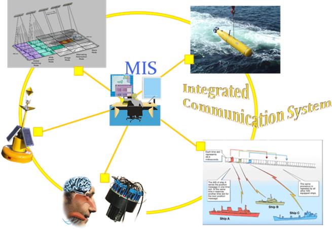
MIS, an informative system customized for marine and maritime applications, results from the integration of modern technologies for environmental monitoring (AUV, sensorized buoys, artificial nose, SAR images, AIS data of the marine traffic) with the most advanced ICT technologies. MIS is designed to process and merge heterogeneous information, accompanied with spatial and temporal distribution, and to provide specific tools for data retrieval, analysis and visualization.
ARGO - Geomatrix and dynamic risk map
The informative system is complemented with ARGO-Geomatrix, a module able to create in real/time a thematic map of the environmental risk, estimated on the basis of all available data. Intuitively, this map provides an immediate and expressive representation of the considered region, and suggest a list of possible interventions to face the danger.
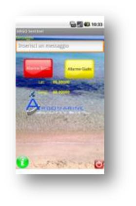
ARGO - sentinel: an app to protect the sea
On the basis of the increasing importance of geographical information provided by volunteers, the Laboratory has developed an app for the reporting of pollution events. This app is able to transform an ordinary smartphone in a sophisticated device for the early warning of critical events.